Tourism in Malargüe
Everything you need to plan your trip to the most complete destination in southern Mendoza. Nature, adventure, snow, gastronomy and much more.
Malargüe, gateway to Mendoza's Patagonia
Spanning over 41,000 km², Malargüe is the largest department in Mendoza and one of the most diverse tourist destinations in Argentina. Located in the south of the province, at 1,400 meters above sea level, it combines mountain landscapes, Patagonian steppe, volcanic fields and high-altitude lagoons.
From the ski resorts of Las Leñas to the 800+ volcanoes of La Payunia, through Caverna de las Brujas and Laguna de Llancanelo, Malargüe offers unique experiences throughout the year for those seeking tourism in Mendoza beyond the conventional.
With a population of approximately 32,000 inhabitants, it preserves the authenticity of a Patagonian town while offering the infrastructure needed to welcome tourists: accommodation in various categories, regional cuisine with the famous Malargüe goat, guided excursions and an airport with direct connections.
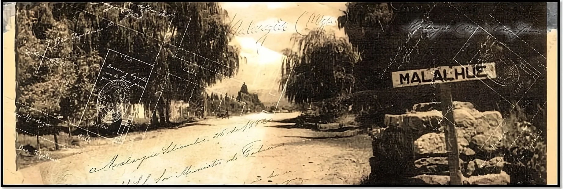
History of Malargüe
The name Malargüe comes from the Mapudungun word «Mal-Al-Hue», meaning «place of cliffs» or «rock corrals». These lands were inhabited for thousands of years by indigenous peoples who left their mark in caves, petroglyphs and the region's place names. The Pehuenche people, skilled experts of the territory, traveled these valleys and mountains making use of the natural resources of the Andes and the steppe.
The official founding of the department dates back to 1886, when it was established as an administrative district of the province of Mendoza. For decades, the main activities were extensive goat farming and mining. Geographic isolation forged a resilient community with a unique cultural identity, a blend of Creole and Mapuche traditions reflected in its gastronomy, folk festivals and way of life.
From the second half of the 20th century, Malargüe began its transformation toward tourism with the opening of the Las Leñas ski resort in 1983 and the installation of the Pierre Auger Observatory in 1999. Today it is a destination that combines its rich historical heritage with a modern tourism offer, where the tradition of spit-roasted goat coexists with cutting-edge science and adventure in landscapes that seem from another planet.
Types of tourism in Malargüe
Discover the different experiences you can enjoy in southern Mendoza
Tourist destinations in Malargüe
The must-see places that make Malargüe a unique destination in Argentina
How to get to Malargüe
Malargüe is connected by national routes and has its own airport
From Mendoza City
400 km via Ruta Nacional 40 South. Approximately 4 to 5 hours by car. Paved road in good condition.
Ruta 40 South · ~4:30 hrsFrom Buenos Aires
Approximately 1,200 km. You can get there via Ruta 40 from Mendoza or via Ruta 143/144 from San Rafael.
~12 hrs by car · Flights availableFrom San Rafael
190 km via Ruta Nacional 144 and Ruta Nacional 40. Approximately 2 hours of travel.
Ruta 144/40 · ~2 hrsMalargüe Airport
Comodoro D. Ricardo Salomón Airport (code LGS). Receives flights from Buenos Aires, especially during ski season.
IATA Code: LGSExplore the map
Discover establishments, destinations and events on the interactive map of Malargüe.
Weather and best time to visit Malargüe
Malargüe has a semi-arid mountain climate with four well-defined seasons. Each time of year offers different experiences.
Summer
December – March
15° to 30°C
Ideal for trekking, horseback riding, visiting La Payunia and Laguna de Llancanelo. Long days and clear skies.
View seasonAutumn
April – May
5° to 20°C
Autumn colors in the valleys. Less tourism, ideal for those seeking tranquility. Good time for the Caverna.
View seasonWinter
June – September
-5° to 10°C
Ski season at Las Leñas. Snow-covered mountains and spectacular white landscapes.
View seasonSpring
October – November
10° to 25°C
Steppe in bloom, rivers with good flow. Excellent for outdoor activities and photography.
View seasonPractical information for travelers
Emergencies
Emergencies: 911 · Fire dept: 100 · Hospital Regional Malargüe · Police: 101
Connectivity
Cell phone signal available in the city and nearby areas. In remote destinations (Payunia, Llancanelo) coverage is limited or nonexistent. Download offline maps.
Fuel
Gas stations in Malargüe city. Fill up completely before heading to remote destinations, as there are no stations along the route.
ATMs and payments
ATMs available in downtown Malargüe. Rural establishments may have limited electronic payment options. Carry cash.
Road conditions
Ruta 40 is paved. Access roads to Payunia and Llancanelo are gravel; a high-clearance vehicle or 4x4 is recommended depending on the season.
Altitude and sun
At 1,400 masl the sun is intense. Wear sunscreen, sunglasses and a hat. Temperature swings are large: bring warm clothes even in summer.
Frequently asked questions about Malargüe
Start planning your trip to Malargüe
Explore destinations, find accommodation and discover everything southern Mendoza has for you.